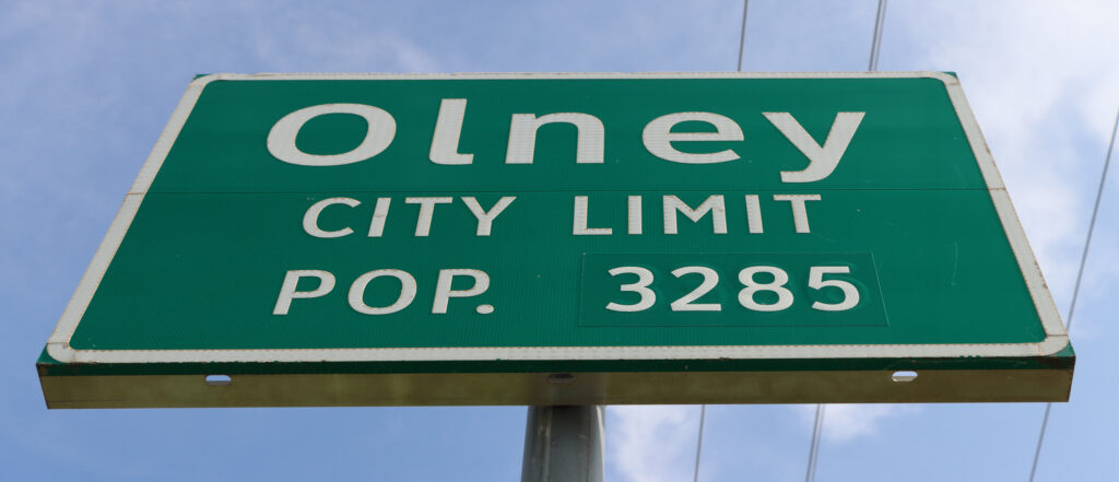
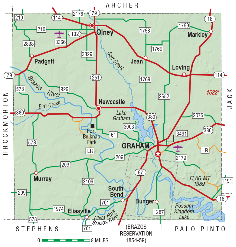
One hundred and thirty four miles west-northwest of Dallas, at the intersection of state highways 114 and 79, lies the town of Olney, Texas, population 3,285. If you’re traveling from Dallas to Lubbock, on what I call ‘the northern route’ (from 380 to 114 to US82), Olney is roughly the halfway point, making it a natural stopping point to fill up, stretch your legs.
You can also get a pretty good chocolate malt in Olney, right at the western edge of town. For the Texans, you can’t miss it: there’s a stop sign out front, the kind that sits way up high on a pole. Says “DQ” on it. That’s the Texas-phonetic spelling of ‘stop’ or ‘whoa.’ For everyone else: it’s the Dairy Queen at 1419 W. Main Street, on the left if you’re headed west on State Highway 114 toward Megargel (10 miles), or on the right if you’re headed east toward Jermyn (25 miles). More Texas-phonetics: ‘Muh-gargle’ and ‘German.’ Go figure.
On one trip, I told the young man behind the counter that stopping at Olney had become a habit, because their malts were good. That’s what old guys like me often do: we offer up our motivations for doin’ stuff, usually unsolicited. And he responded like young people in small towns often do: in a polite and friendly way.
The ice cream machine was old, he told me, and they’d soon be getting a new one. The old one was was difficult to operate, with lots of levers and knobs, but it still made really good ice cream. I agreed. Chambers of Commerce and Economic Development boards do all manner of things to attract businesses and visitors to their towns–nothing new there, of course–but sometimes it’s the little things that first catch your interest, like a pretty good chocolate malt, and friendly service.
The purpose of this site, is to find and share the stories of the people and places, along the way from Dallas to Lubbock. You might think there’s nothing unique or ‘story worthy’ about a chocolate malt from a Dairy Queen franchise. And you might be right. In an online review of this particular location, one customer seemed to agree: “This is your typical Dairy Queen in small town Texas.”[1]Heartbreaker: Farewell to Dairy Queen
But stories don’t tell themselves. You have to dig a little, stay persistent, and see where they take you. That same online reviewer continues on: “Every Sept 1, the masses descend on central Texas to hunt birds. This DQ is the place to stop and refuel between morning and evening hunts.” OK, so this gives us: ‘bird hunters at a DQ in Texas’–but still no story line there, really. Unless, of course, you happened to be there around Labor day weekend, and you noticed that several of these hunter-customers had only one arm. Now you’d have this: ‘a bunch of one-armed bird hunters at a DQ in Texas.’ If you don’t find that to be story worthy, then I’m afraid I can’t help you.
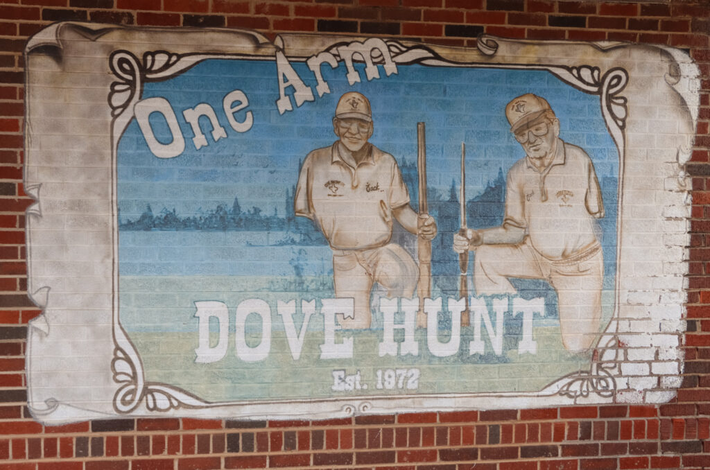
Olney’s first “One Arm Dove Hunt” was held in 1972. The 50th anniversary hunt–now called the ‘Olney Amputee Dove Hunt’–took place September 10th and 11th, 2021, and drew amputees, family, friends and interested onlookers like me (attendance normally runs in the hundreds) from Texas and around the US and Canada.
Jack Bishop and Jack Northrup–each of whom had lost an arm, and who were referred to as ‘the One-Armed Jacks’–came up with the original idea at (of course) the lunch counter at the drug store (yes, the drug store’s still there) at 116 Main Street. Attendance has grown steadily over the years, expanding to a two-day event, with food (including breakfast, priced at “10 cents a finger” so that’s $1 for all you fullly-fingered folks), live entertainment, golf scramble, a trap shoot, silent and live auctions, cow chip throwin’, and of course, the dove hunt.
Current organizers describe it this way: “The primary purpose of the event…is for is for upper-limb amputees to exchange stories, find friendship and support, and swap tips for living with missing upper-limbs.” Can’t beat that.
Full disclosure: Dove hunting’s not for me. I tried it once, many years ago. Got lucky and hit and killed the bird with one shot–the first and last shot I will ever fire at a dove. Because I felt bad about it. But no judgement from me on this or other topics here–the purpose of this site is to honor the people and their stories, not judge them.
Instead I’ll call attention to the stories I’ve heard and read from the amputee participants, many of whom return every year, because of the respect and fellowship this truly unique event affords. But the help goes both ways–the amputee participants, as well as those who organize and keep this event going are inspirational for me too. They’re a reminder for me to be thankful for what I have, and often take for granted.
The stories surrounding this event are endless, but I’ll offer just two. First about Tommy Fergerson, and his video “1 Arm Skydiver One Arm Dove Hunt“–title self-explanatory and equally inspiring.
And finally this one, a combination of the wit and grit and humor I’ve seen in so many of the people I’ve met so far: For a charity basketball game during the Dove Hunt event some years back, the One-Armed Jacks were enlisted to do the officiating. Asked if they were up for the task, they said they could get up and down the court just fine, but that violations for ‘traveling’ might take a bit longer, as they’d have to cooperate to make the call–with each contributing their one arm to the process. You can’t make this stuff up.[2]Thanks to Lori Cox for re-telling this great story to me
***
This site began with the simple idea that if I would just take the time to slow down and look around, at these places I’d always rushed through, that interesting stories—some humorous, some tragic but in all cases life affirming—would be all around. I spent a few of my childhood years in a small town in (Monett, Missouri, [then] population 5,937) so I had some idea this was true. But after just a few weeks of work and conversations, all my expectations have been exceeded.
In and around just this one locale, there are still-vivid stories of the past—of “life before the fences” when this was tall grass prairie; stories of the present, like the Dove Hunt; and stories unfolding into the future: new families moving in, some from out of state, renovating and restoring historic properties; other local families starting new ventures, or setting their children up with businesses of their own.
On a much larger scale, a scale that surprised me: Tower Extrusions, one of the largest independent aluminum extrusion companies in the US, is based in Olney—and busing in workers from nearby Wichita Falls in order to meet their strong demand. Air Tractor, a world-leading, employee-owned manufacturer of aircraft for agricultural, firefighting and law enforcement applications, is based in Olney. Cemco, a pioneering and still-leading manufacturer of mobile cement batching and mixing technology, was founded in Olney in 1975, and is going strong today, both in their industrial operations, and with the Perry’s Foundation, actively working to improve the quality of life in Olney and Young County.
This site is not an ‘advertisement’ for the town. No one put me up to it, and not a word of it is exaggerated. There’s good and bad here, like everywhere. These and so many other people and their stories, are simply what I found, when I slowed down, and looked around. And I’m just getting started.
References
| ↑1 | Heartbreaker: Farewell to Dairy Queen |
|---|---|
| ↑2 | Thanks to Lori Cox for re-telling this great story to me |
| ↑3 | Texas Almanac |